The Processing Challenge
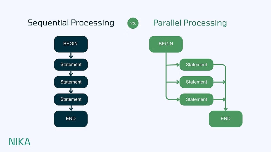
Think of data processing like going through airport immigration. Traditional sequential processing is like having just one immigration officer - everyone waits in a single line, with data chunks processed one at a time. It's about as fun as it sounds.
Parallel processing, however, opens multiple counters simultaneously. Instead of processing data one piece at a time, it handles multiple pieces simultaneously, like having several immigration officers working at once.
Making It Work
Many spatial algorithms were originally designed not necessarily focused on computing efficiency. That's where modern solutions come in - redesigning these processes to work smarter, not harder.
The results are impressive: with just a small upfront cost of switching when Nika converts these sequential processes into parallel ones, our clients have seen their data processing become more than 8 times faster. They have seen high ROI and an improvement of at least 800%!
Looking Forward
The shift to parallel processing isn't just about speed, it's about unlocking new possibilities in spatial analysis. As datasets grow and analysis becomes more complex, the ability to process data efficiently becomes not just a nice-to-have, but a necessity for modern GIS workflows.
Ready to tackle bigger projects and deliver them on time? Let's chat on how parallel processing can transform your GIS workflows.