Among many, these companies have successfully utilized location intelligence and they come ahead than others.
In the corridors of corporate leadership today, conversations about digital transformation abound.
Yet amid discussions of AI implementation, cloud migration, and data governance, one critical dimension is frequently overlooked: the spatial component of business data.
This oversight represents not merely a technical gap but a significant strategic blind spot.
Every aspect of business—from supply chain optimization to customer engagement, from operational efficiency to market expansion—exists within a spatial context.
The companies gaining competitive advantage in 2025 are those that recognize location data as a core strategic asset rather than a specialized technical concern.
Spatial data has evolved far beyond traditional mapping applications. Today's leading organizations view their geospatial information as a dynamic intelligence layer that contextualizes and enhances every business decision.
This evolution represents a fundamental shift in thinking: location is no longer simply a field in a database but a multidimensional lens through which to view operations, opportunities, and risks.
When properly integrated into business processes, spatial intelligence reveals patterns and relationships that remain invisible in conventional analytics.
The question facing executives is no longer whether spatial data matters to their organization, but rather how quickly they can harness its strategic potential before competitors do.
Let's study how each company has successfully utilized location intelligence and came on top.
3 Business Cases
1: Maersk

Photo credit: Maersk
During the supply chain crisis of 2021, Maersk North America faced unprecedented disruptions with shipment lead times varying from 35 to 75 days. Rather than implementing purely reactive measures, the company established an innovation center focused on enterprise-wide spatial intelligence to address both immediate bottlenecks and long-term resilience.
By leveraging spatial analysis of container movements and transportation networks, Maersk created the strategically positioned Pacific Transload Express facility near Vancouver's container terminals. This spatially-optimized solution reduced lead time variability by 46%, creating much more predictable 35-40 day delivery windows.
The company also deployed drones with spatial mapping capabilities in warehouses, collecting 3D scans processed through spatial analytics to virtually eliminate inventory "leakage" – previously accepted at 5-10% of goods.
"Supply chain disruption is a constant," noted North America Regional Managing Director Narin Phol. What distinguished Maersk's approach was integrating spatial intelligence throughout the organization rather than treating it as an isolated technical function
2: Starbucks
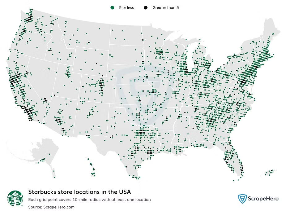
Image credit: ScrapeHero
The success of Starbucks' global expansion is driven by sophisticated location intelligence integrated throughout their operations. With advanced geospatial analytics, the company transforms raw geographic data into actionable insights that guide strategic decision-making at every level.
When identifying potential sites for new store openings, Starbucks conducts detailed spatial analysis of local demographic profiles, economic indicators, and environmental conditions. This approach ensures each location is strategically positioned for both immediate visibility and long-term profitability.
The power of this strategy was demonstrated during a Chicago cold spell when Starbucks' real-time location analytics detected neighborhood-specific surges in hot beverage demand. Stores in key areas proactively adjusted inventory levels, resulting in a 23% sales increase compared to locations relying solely on historical data.
In 2019, Starbucks enhanced their spatial capabilities through a strategic partnership with Microsoft Azure, incorporating dynamic data streams like social media trends and local event schedules into their analytical models. This integration has allowed the company to design store layouts based on geographic customer distribution, tailor offerings to regional preferences, and deploy location-specific promotions that resonate with community-specific tastes.
3: Shell

Photo: Shell
Shell, the world's largest retailer with 44,000 retail gas stations across 75 countries, faced a significant challenge in leveraging its vast loyalty program data. The company was struggling with a time-consuming, manual process of analyzing customer behavior on a site-by-site basis, which prevented them from gaining comprehensive market insights.
In response, Shell expanded its custom-developed geospatial solution to visualize purchasing behavior of loyalty program customers in proximity to both Shell and competitors' locations. The spatial intelligence platform integrated previously siloed data streams into a unified geo-dashboard that provided instant visibility across markets.
This approach allowed pricing analysts to create near real-time thematic map layers based on aggregated customer data, revealing patterns in customer catchment areas – whether customers were primarily travelers or local residents. The system enabled Shell to analyze site performance, monitor pricing strategies, and make data-driven decisions about competitive positioning.
The results were immediate and substantial. Within just three months of implementation, Shell generated €3.3 million in additional revenue in Germany alone. The solution has since been deployed across 28 countries, transforming how the company understands customer behavior and makes pricing decisions.
Key Takeaway
The organizations that thrive in this environment will be those that recognize spatial information as a core strategic asset rather than a specialized technical concern. They will develop the governance structures, technical capabilities, and organizational competencies needed to leverage location intelligence at enterprise scale.
The question facing leadership teams is straightforward: Will your organization be among those that shape the future through spatial intelligence, or will you find yourself navigating an increasingly complex business landscape without the geographic context needed to understand it fully?
The technology exists. The methodologies are proven. The potential value is clear. What remains is the executive vision and commitment to transform spatial data from an underutilized resource into a strategic advantage.
Learn how Nika can help your organization develop and implement an effective spatial data strategy. Our team has guided transformation journeys for organizations across industries, combining technical expertise with strategic insight. Schedule a confidential executive call to discuss your specific opportunities and challenges.
About Nika
Nika is the company behind NikaPlanet, the planetary scale spatial data and AI platform. We're helping organizations move beyond legacy GIS systems to unlock the full potential of their spatial data with cloud-native technology, AI-powered analysis, and collaborative workflows. Our mission is to make spatial intelligence accessible and actionable for every organization.