Mosaic Processing: Stitching Together the Bigger Picture
One of the most common and visually striking types of spatial processing is “mosaicking.” Imagine a stunning photo capturing a vast area in intricate detail—like the one below. You might wonder how a single drone with a small camera manages to capture such a large expanse.

Photo: Ryan Searle, 2017. Unsplash.
The truth is, it doesn’t. Instead, the drone collects multiple images as it flies over the area. Mosaic processing comes in to stitch these individual images together into one seamless, high-resolution map. It aligns and references the images to their exact locations on a map, producing the unified visual representation you see.
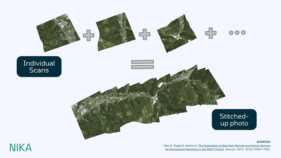
Courtesy of: Meo R, Roglia E, Bottino A. The Exploitation of Data from Remote and Human Sensors for Environment Monitoring in the SMAT Project. Sensors. 2012; 12(12):17504-17535.
This process is the backbone of creating accurate and visually coherent geospatial products, whether for environmental monitoring, urban planning, or disaster management.
Beyond Mosaics: Tackling Complexity
While mosaics are a relatively straightforward example, many other types of spatial data processing are more complex. Techniques like cloud removal algorithms and atmospheric corrections are vital for ensuring the quality and usability of satellite imagery. These processes filter out distortions caused by weather conditions or atmospheric interference, but they are often time-intensive and computationally demanding.
One key challenge is that much of this technology originates from academic research, which means it isn’t always optimized for speed or scalability. These inefficiencies can create significant bottlenecks in real-world applications where timely insights are critical.
In the next installment of this series, we’ll explore these more advanced techniques and discuss how Nika is addressing some of the biggest pain points in spatial data processing. By leveraging innovative solutions, we’re making these processes faster, more efficient, and accessible to a wider range of users.
Stay tuned!